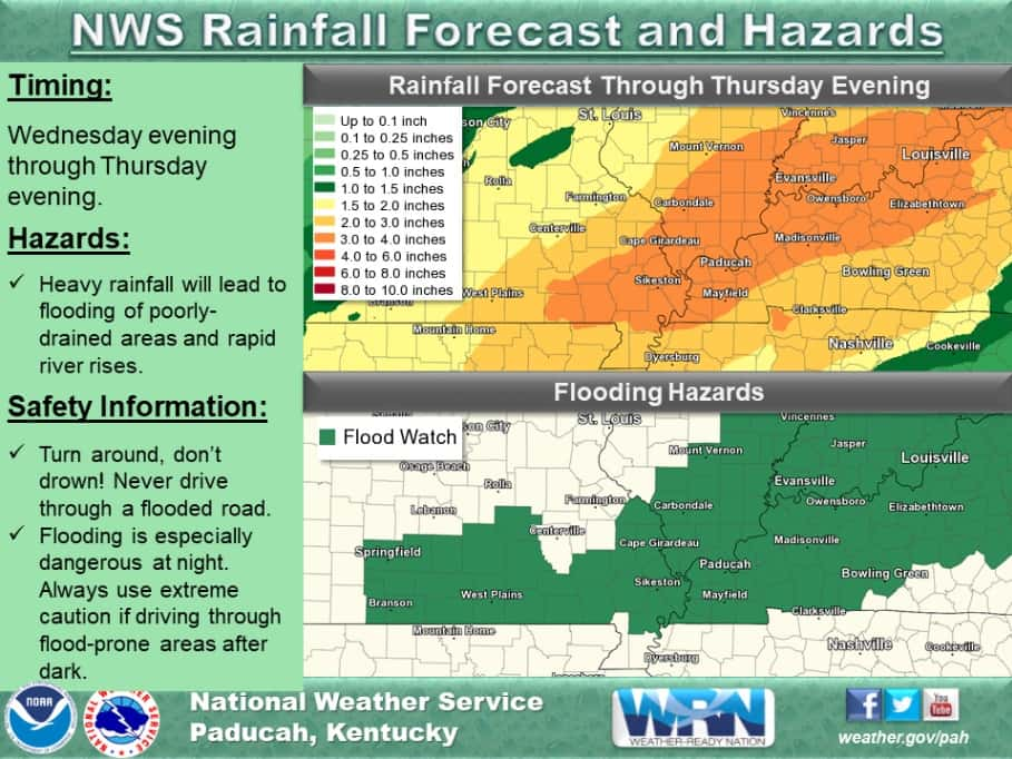
The National Weather Service in Paducah has issued a Flood Watch in effect from Wednesday evening through Thursday evening for all of western Kentucky.
Meteorologists say occasional showers and scattered thunderstorm are forecast in waves starting Tuesday night and continuing through Thursday evening, resulting in periods of moderate to heavy rainfall with two to four inches of rainfall likely. They note locally higher amounts are possible, especially in locations that receive repeat thunderstorm rains.
According to meteorologists, the heavy rain will likely cause flooding of low lying and poor drainage areas, in addition to rising water levels on area rivers, creeks, and streams. Localized flash flooding cannot be ruled out with scattered thunderstorm producing heavier rainfall rates.
A Flood Watch means there is a potential for flooding based on current forecasts. You should continue to monitor later forecasts and be alert for possible Flood Warnings. Those living in areas prone to flooding should be prepared to take action should flooding develop.
Remember…Turn Around Don’t Drown.
We will keep you updated on all the weather changes on Your Weather Edge on Facebook and at whvoradio and wkdzradio.com.