The weather pattern for west Kentucky will shift dramatically over the next 48 hours — starting Friday night with heavy rains and a slight potential for storms, moving through Saturday with more heavy rains and an enhanced risk of severe weather, before temperatures bottom out Sunday morning to below freezing.
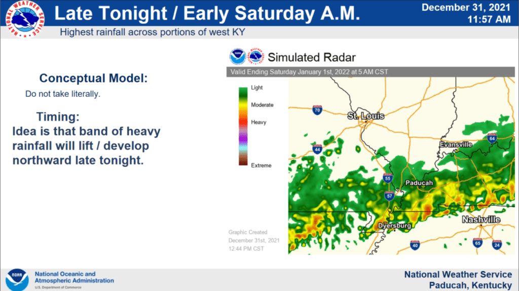
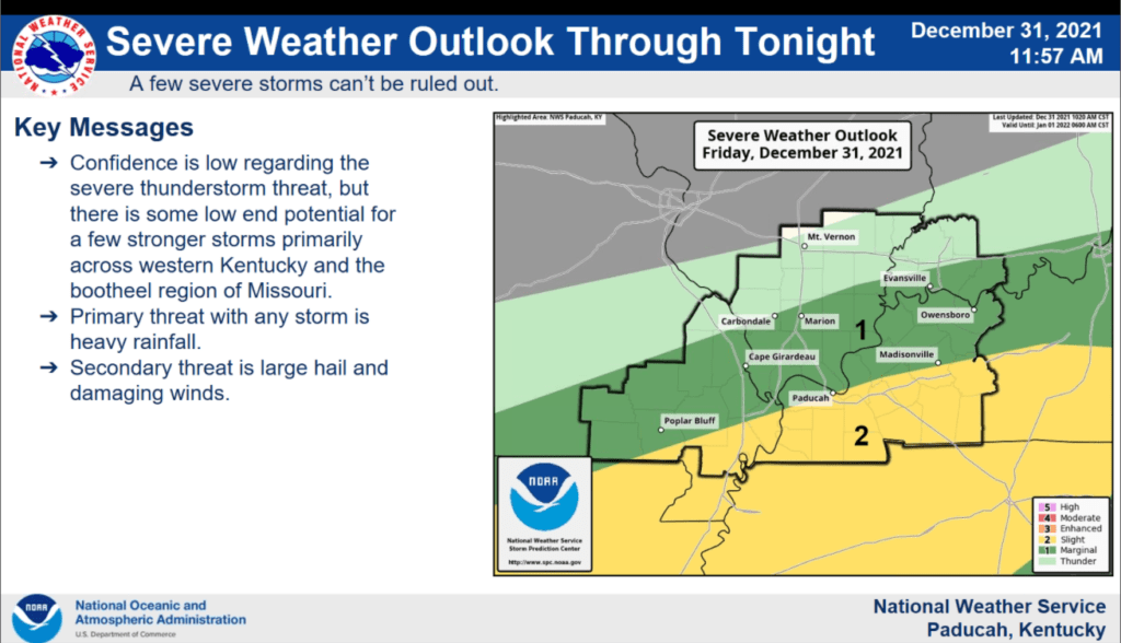
During Friday’s conference through the Paducah office of the National Weather Service, Meteorologist Mike York said those in west Kentucky should expect a band of heavy rain to lift northward from the Kentucky-Tennessee border Friday night, where a small chance of severe weather exists.
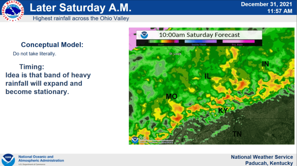
Saturday, widespread heavy rain is expected along a stationary front that will sit on top of the Ohio Valley. By afternoon, York added a linear thunderstorm system — much like a squall-line — would move eastward, and should be past Hopkinsville by 4-5 p.m.
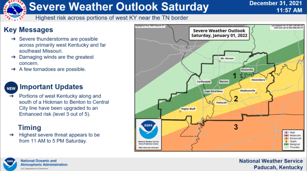
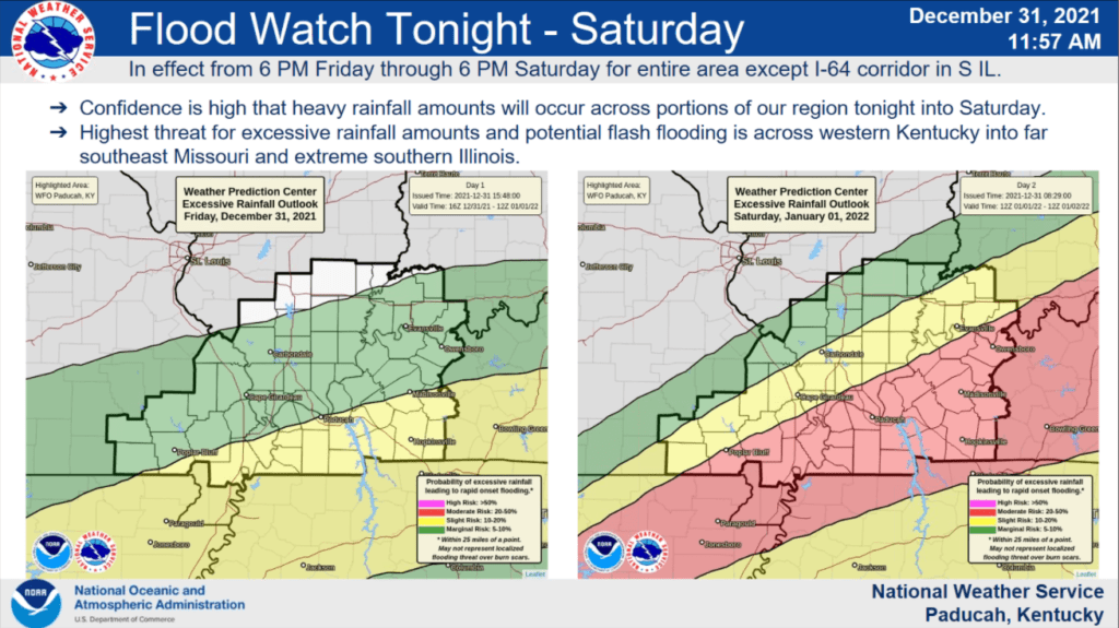
Saturday’s severe weather outlook has also changed from earlier-in-the-week models. York noted the Storm Prediction Center has expanded its level 3 “enhanced” risk of damaging storms to just north of the Kentucky-Tennessee state line — clipping Fulton, Graves, Calloway, Trigg, Christian and Todd counties, in what looks like a corridor from Hickman, through Benton and on to Central City.
With this enhanced risk comes the potential for damaging winds, hail, torrential rains and possible tornadic activity.
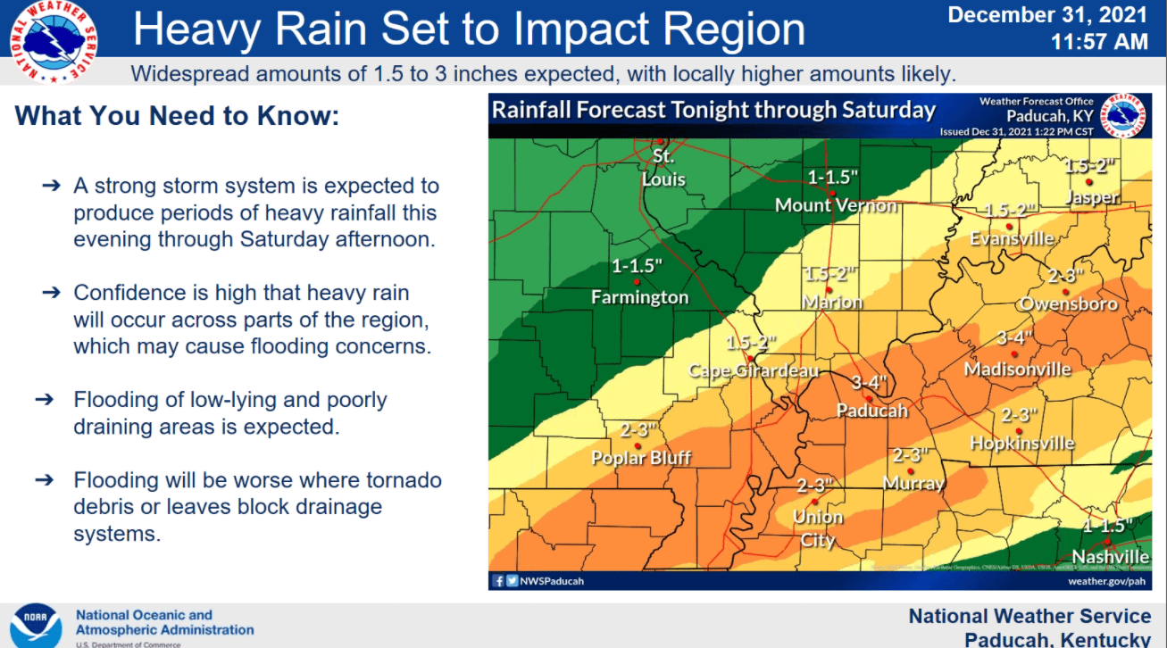
Average amounts of rain in the next 24 hours should be in the 2-to-4-inch range for most of the News Edge listening area, but York noted it wouldn’t be surprising if some pockets reported higher amounts — as some of these thunderstorms could be training.
Training means repeated areas of rain move over the same region in a short amount of time, which leads to more flash flooding — which is another concern for west Kentucky, following the damage wrought December 10 and 11.
Caldwell County Emergency Manager Joey McCaslin said a slight concern with this storm system is that Eddy Creek bore the brunt of damage that Friday.
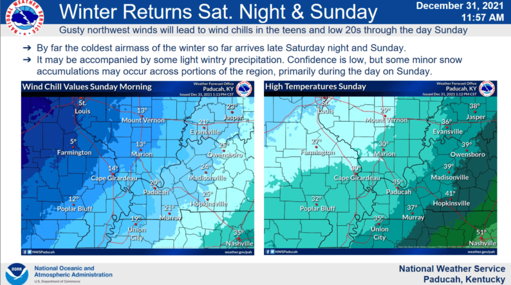
Behind this front, temperatures will plummet — dropping from the upper 60s Saturday to the low 30s by Sunday morning, with potential for a wintry mix of precipitation.