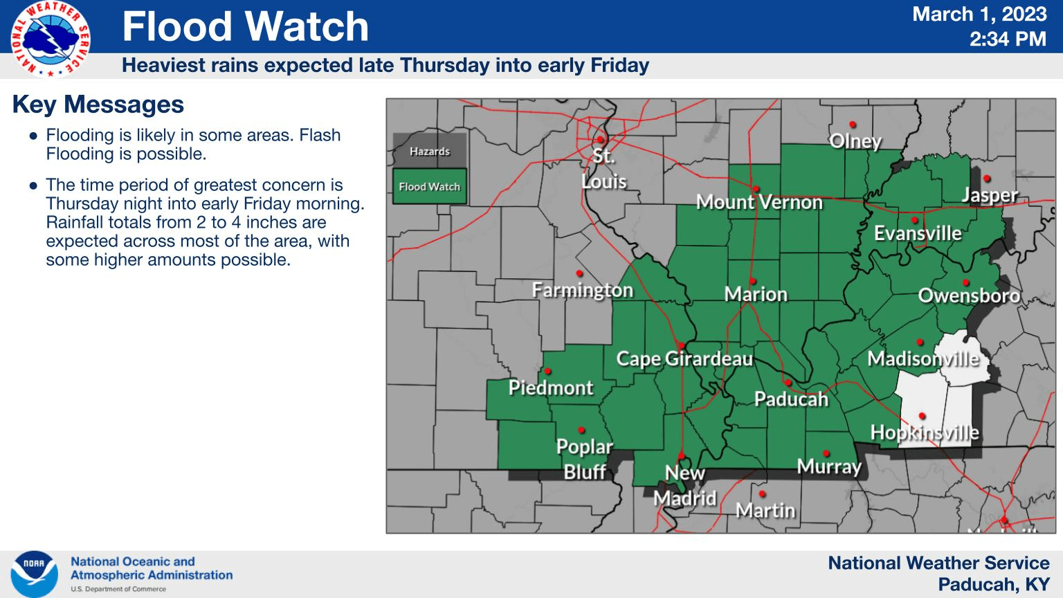
The next round of storms will arrive Thursday night and bring with it a chance for flooding and gusty winds, with a few severe thunderstorms possible.
The National Weather Service in Paducah has issued a Flood Watch for Caldwell, Hopkins, Lyon, and Trigg counties from 6:00 Thursday night to Noon Friday. Forecasters said excessive runoff may result in flooding of rivers, creeks, streams, and other low-lying and flood-prone locations. The possibility also exists that low-water crossings may be flooded. Most areas under the watch are expected to see 2-3″ of rainfall, with some locations possibly exceeding 4″.
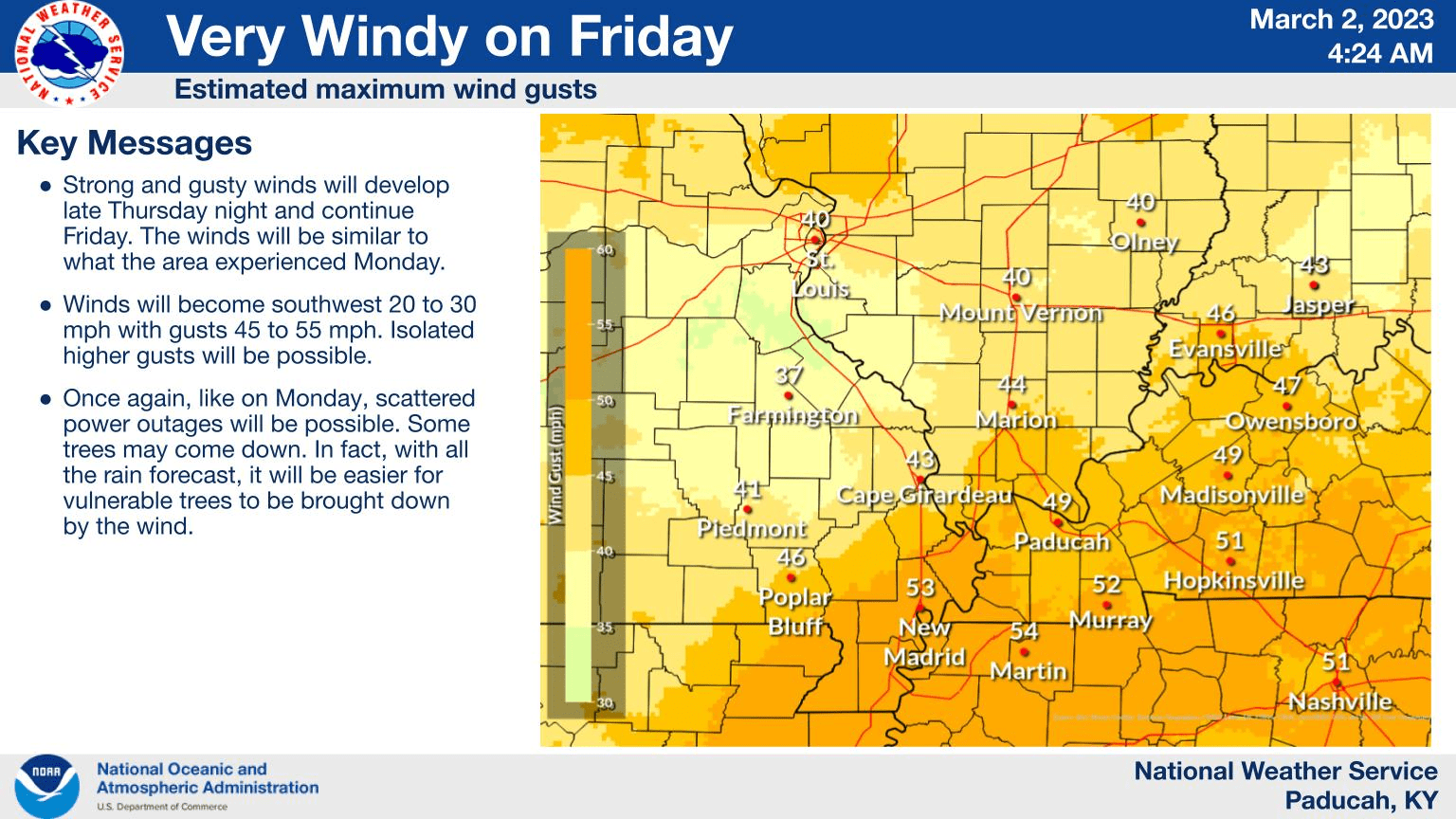
Also, nearly the entire state of Kentucky and most of Tennessee are under a Wind Advisory, that goes into effect Friday.
The local advisory calls for southwest winds 20-30 MPH, with gusts up to 50 MPH expected from 6:00 Friday morning to 9:00 Friday night.
The NWS said gusty winds could blow around unsecured objects, tree limbs could be blown down, and a few power outages may occur. They added you should use extra caution when driving, especially if operating a high-profile vehicle, and make your outdoor objects secure.
Your Weather Edge will keep you informed online and on-air with WKDZ, WHVO, and WPKY.