The Paducah office for the National Weather Service concluded its investigation of the Hopkinsville area late Saturday afternoon — which needed a full range of observation following Friday night’s torrential storm front.
Christine Wielgos, warning coordination meteorologist, noted her team determined that a tornado did not spawn or enter Christian County, and instead concurred all the damage came from other weather phenomena.
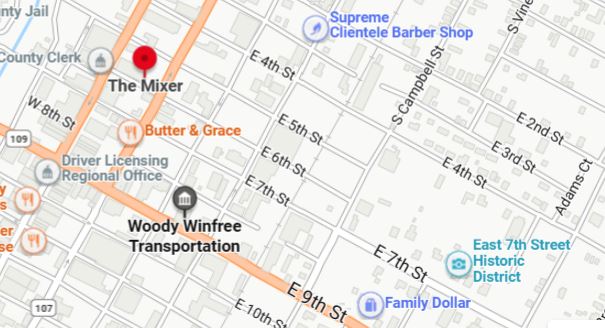
Those two buildings of which she speaks include The Mixer restaurant and the Woody Winfree Museum — both located near the heart of downtown Hopkinsville — while other scattered damage was recorded around town.
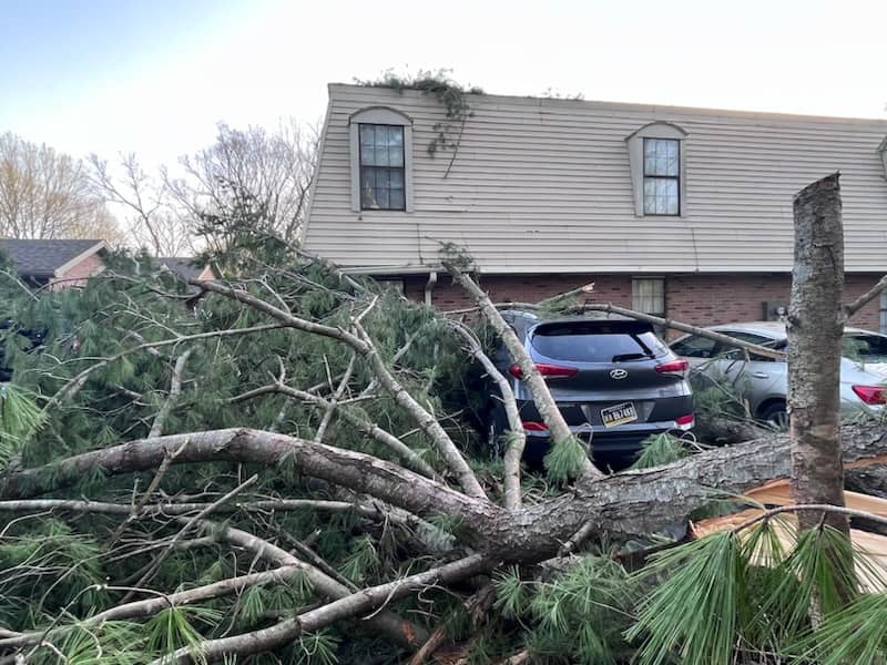
She said many sheds had trees and limbs on them, and several homes had “major damage.”
One difficult part of the job, she added, was discerning damage created from Friday night’s activity, and the storms that occurred on March 3. She said Christian County Emergency Management was able to point out many of those differences as they went along, and that many of the trees that succumbed to the winds were likely “older, weaker” trees.
The damage from March 3, she said, was actually much worse and more widespread, but Friday added even more troubles.
Wielgos said there was no specific “narrow path” for the damage, which would properly indicate tornadic activity, but that elevation may have contributed to faster wind speeds in different parts of town.
Knowing the average age of downtown Hopkinsville’s architecture, Wielgos said the observations weren’t easy.
As of Saturday evening, Wielgos and the team were already bound for other surveys in west Kentucky, with plans to investigate areas of Henderson and Union counties for suspicious weather patterns stemming from Friday night’s blast.