
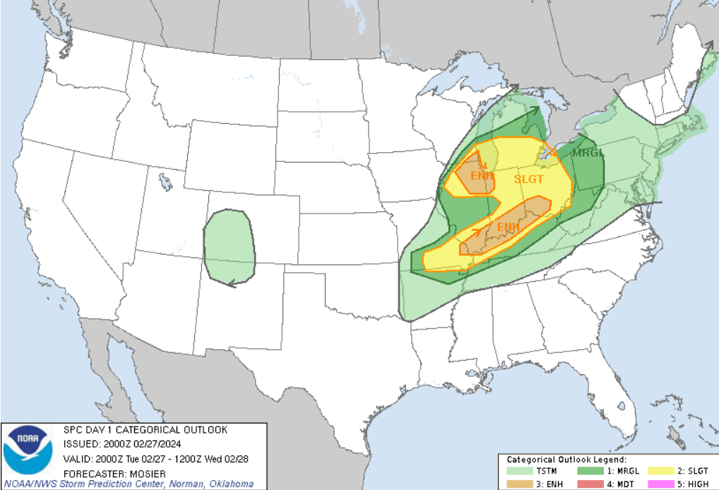
Hey everyone, the weather continues to change back and forth on what we can expect as a strong cold front approaches this evening. The Storms Prediction Center has increased the severe threat across the region, especially from the Pennyrile Region back to the northwest in Illinois and Indiana. Currently Northern parts of the Pennyrile Region are in the edge of the “Slight risk, while areas either side of the Ohio River are in the “Enhanced” Risk.
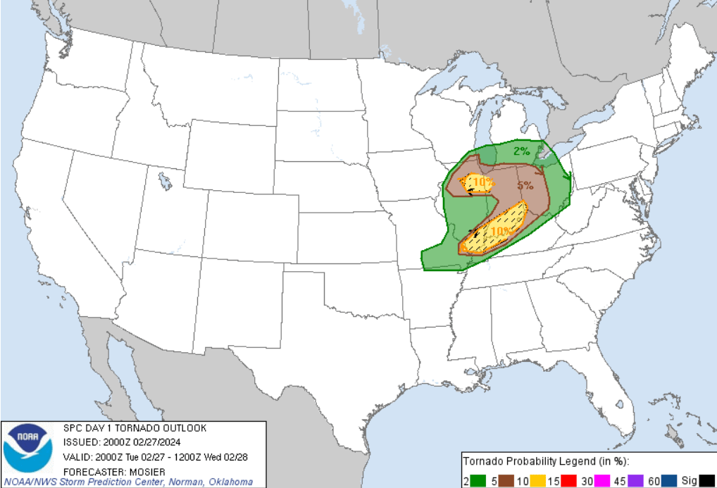
The tornado threat looks a little high as shown below, so we will need to keep an eye on things.
Sometime around midnight a line of storms is expected to for north of the Ohio River and begin moving southeast just ahead of the cold front. It should reach the Pennyrile Area by around 2 AM. This will be when the strongest storms will arrive. However, they are expected to weaken as they approach partly due to the time of day when the instability is weakening.
Hopefully we will get through this without any issues, but we will need to be watchful. Wednesday morning we will see rain showers before 9am, then a slight chance of snow showers through noon. Some thunder is also possible. Cloudy through mid-morning, then gradual clearing, with temperatures falling rapidly to the mid 30’s by 10am. Northwest winds 10 to 17 mph, with gusts as high as 25 mph.