Weather forecasters are saying the greatest chance of severe weather this weekend will happen on Sunday although some thunderstorms are possible later this evening across western Kentucky.
Keith Cooley with the weather service office in Paducah said there will be a slight risk of strong to severe storms today, especially in far western Kentucky.
click to download audioHe said the storms later today and tonight could bring quarter-size hail and 60 mph wind gusts.
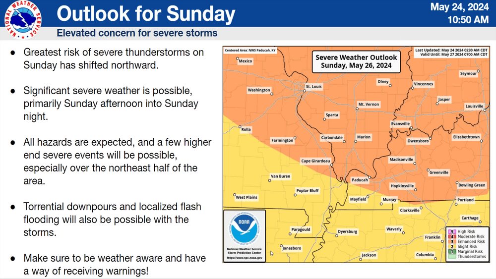
click to download audioCooley said Saturday’s weather shows a low risk of storms before things pick up on Sunday. He said the latest models have shown the greatest threat shifting north while some areas could see some storms Sunday morning as the first wave moves through.
click to download audioThe latest models show the bottom edge of the enhanced risk along the Kentucky-Tennessee border, with a 30 to 40% probability of severe weather with all hazards possible.
click to download audioCooley said with the number of people outdoors this weekend, it’s important to have a plan to monitor the weather and any watches and warnings associated with them.
click to download audioCooley also said flash flooding is a high risk with over nine inches of rain received in western Kentucky this month.