Weather forecasters with the National Weather Service in Paducah continue to monitor the potential for severe thunderstorms on Sunday.
Senior Forecaster Keith Cooley says the last half of the Memorial Day weekend is still looking very active with severe weather across the quad-state area, including western Kentucky.
According to Cooley, Saturday’s weather will be fairly nice and quiet with high temperatures in the 80s under partly cloudy skies. However, he says conditions will quickly change as early as late tonight and early Sunday morning with a severe weather threat lingering into Sunday evening.
Cooley indicates there is the potential for two rounds of severe weather occurring on Sunday with all hazards possible including flash flooding.
He stressed that it is crucial to stay weather-aware throughout the entire day on Sunday, especially if you plan on camping, boating, hiking, or if you have any other outdoor activities planned during the Memorial Day holiday weekend.
To ensure you receive timely watches or warnings, make sure you have a reliable method for receiving weather alerts. In addition, Cooley suggests identifying sturdy structure options in advance and knowing where to go if a warning is issued can significantly increase your safety during a weather event so that you are prepared and not caught off guard.
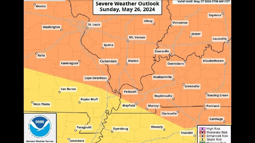
With the exception of a small area west of Mayfield and Murray, most of western Kentucky is under an enhanced risk (orange on graphic) of severe weather on Sunday.