Dry conditions and a continuing drought in the Quad State area have National Weather Service forecasters concerned early on — with some rain and storms on the way later this week, and into the next.
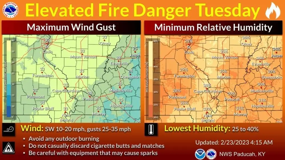
During Monday’s weekly conference out of Paducah, office lead Keith Cooley said the week opens with an “elevated fire danger” Tuesday, before warmer, wetter conditions arrive.
Right now, he said humidity is at 25-to-30% for most parts of the region, and isolated wind gusts could be 40 miles per hour before Wednesday.
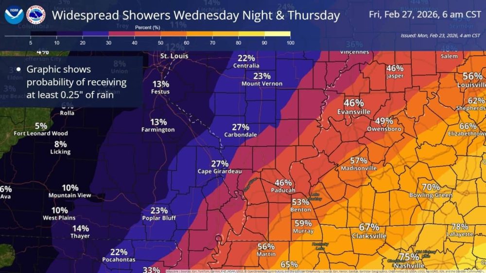
A cold front will move through Wednesday night and into Thursday, Cooley added, bringing with it anywhere between a quarter-inch and three-quarters of an inch, but it’s not the “drought-buster” this area needs.
One might think all the recent snow and ice, following its melt, was enough to break what’s been a really dry winter.
Cooley said that’s not the case.
The region should see gradual warming Tuesday through the rest of the week, with temperatures reaching the low 60’s and 70’s by next week — where “above normal” temps and “above normal” precipitation could finally break this dry, cold spell.
It’s too early to tell if it will be a severe weather pattern.
Cooley said he has seen social media posts claiming “a big snow” coming next week, instead of rain, but he noted early trending models have most of the colder precipitation as far north as Chicago, and perhaps further.