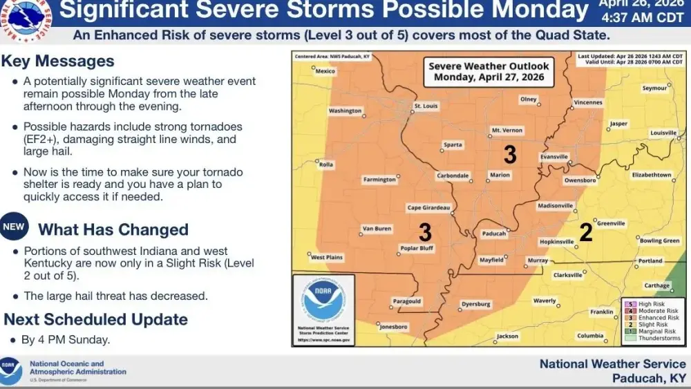
The National Weather Service is continuing to track potential severe weather that is expected to pass through western Kentucky Monday afternoon and evening.
The latest forecast models show an enhanced risk of severe weather west of a line that extends from Owensboro through Calloway County. The southern Pennyrile area is under a slight risk of severe weather Monday afternoon and evening.
The National Weather Service says the main threat includes tornadoes, damaging straight line winds, and large hail.
Forecasters say one of the biggest uncertainties for this potential severe weather is the storm mode. The initial storm development will be in the form of supercells capable producing tornadoes and very large hail. As the storms move east into/across the Quad State, they will likely grow upscale into a squall line during the evening. The squall line would be capable of producing widespread damaging winds and tornadoes.
The consensus at this point is for the transition to a line of storms to occur before they reach the Quad State late Monday afternoon or Monday evening.
Your Weather Edge will be on duty to keep you informed in the event severe weather impacts the region Monday afternoon or evening.