
SPRING STORMS
A warming trend commences Friday, returning us to well above normal temperatures by this weekend, with highs from the middle 70s to near 80 degrees Saturday through Monday. As winds increase, fire danger will be heightened mainly
A warming trend commences Friday, returning us to well above normal temperatures by this weekend, with highs from the middle 70s to near 80 degrees Saturday through Monday. As winds increase, fire danger will be heightened mainly
Hey everyone, the weather continues to change back and forth on what we can expect as a strong cold front approaches this evening. The Storms Prediction Center has increased the severe threat across the region, especially from
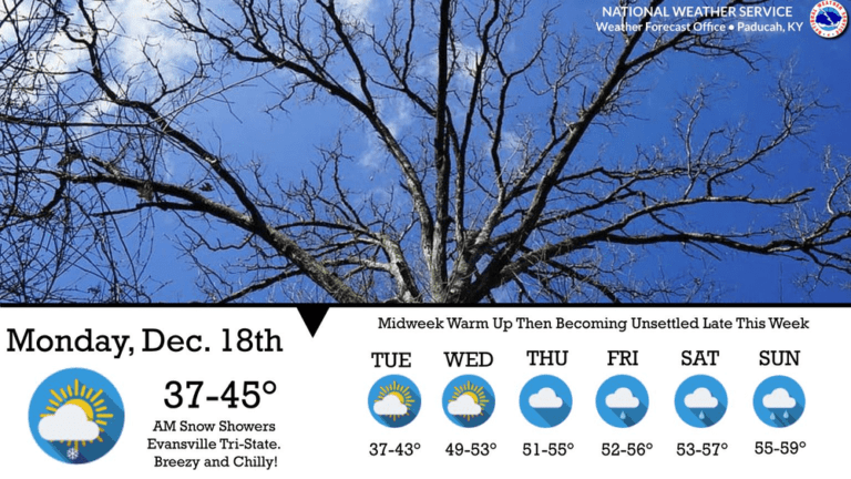
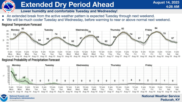
Gusty northwest winds will pick up Monday afternoon and evening and bring with it much cooler temperatures before a midweek warm-up.
Highs struggling to get into the 60s is the forecast for this weekend.
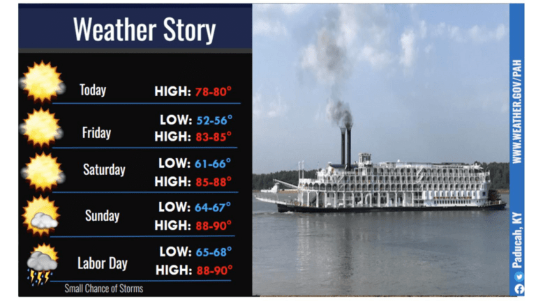
As we dive into Labor Day weekend, the thermometer will show some warmer temperatures and no chances for precipitation.
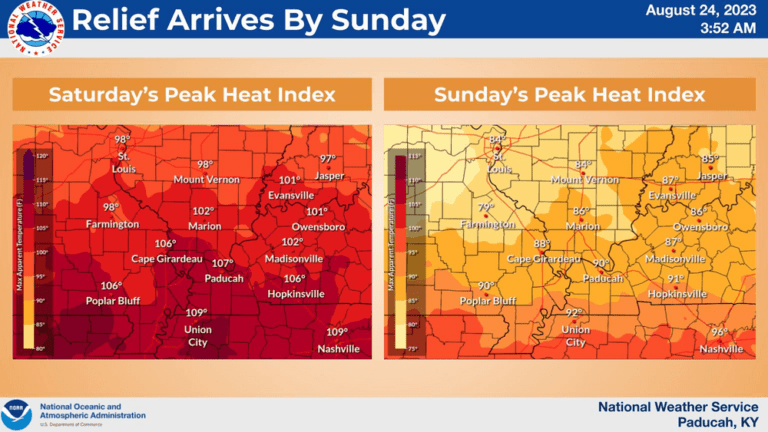
A cold front making its way through western Kentucky Friday night will start to bring some much-needed relief from the dangerous heat we’ve experienced this week.
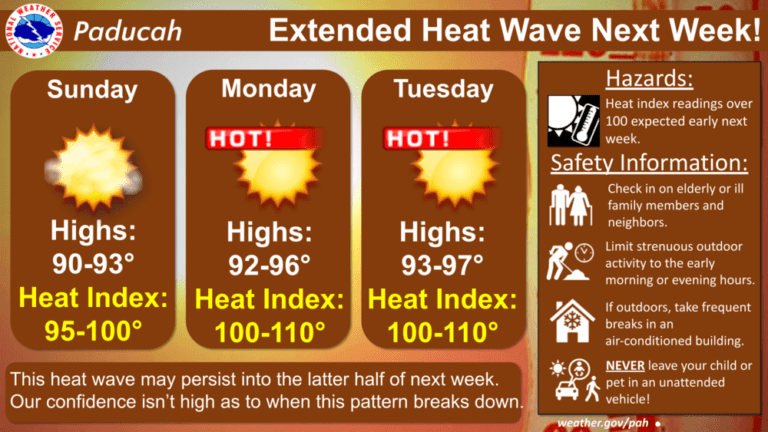
September-like temperatures will stick around through Saturday, before heat and humidity return at the beginning of next week.
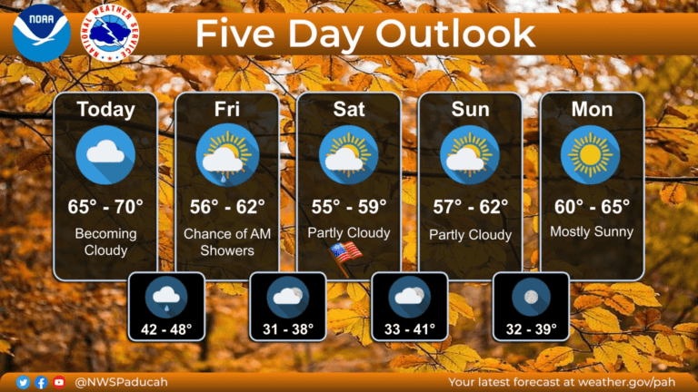
After rain and storms through the weekend, sunshine will prevail through the upcoming week.
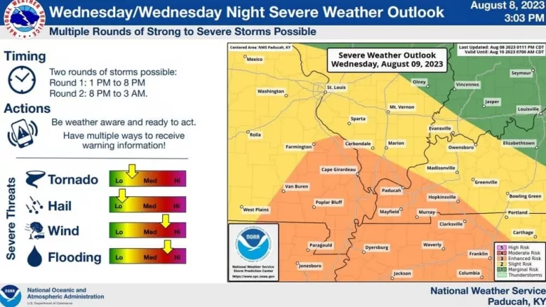
The National Weather Service in Paducah says that two rounds of severe weather are possible Wednesday.

After a rainy Thursday, the forecast continues to call for a daily chance for showers and storms through the weekend.