

Powell Calls For A “Pretty Fall” This Year
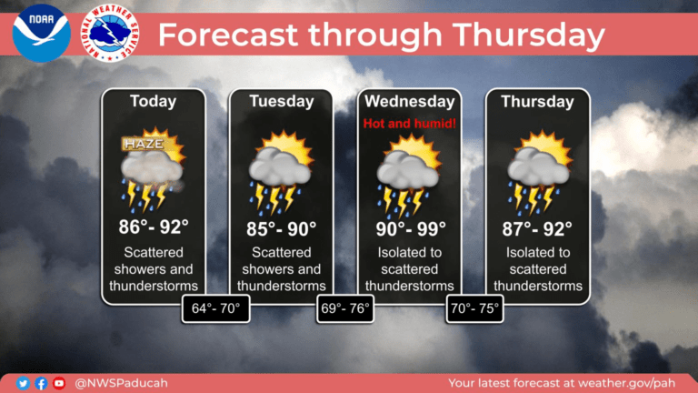
After a rainy Thursday, the forecast continues to call for a daily chance for showers and storms through the weekend.
After a rainy Thursday, the forecast continues to call for a daily chance for showers and storms through the weekend.
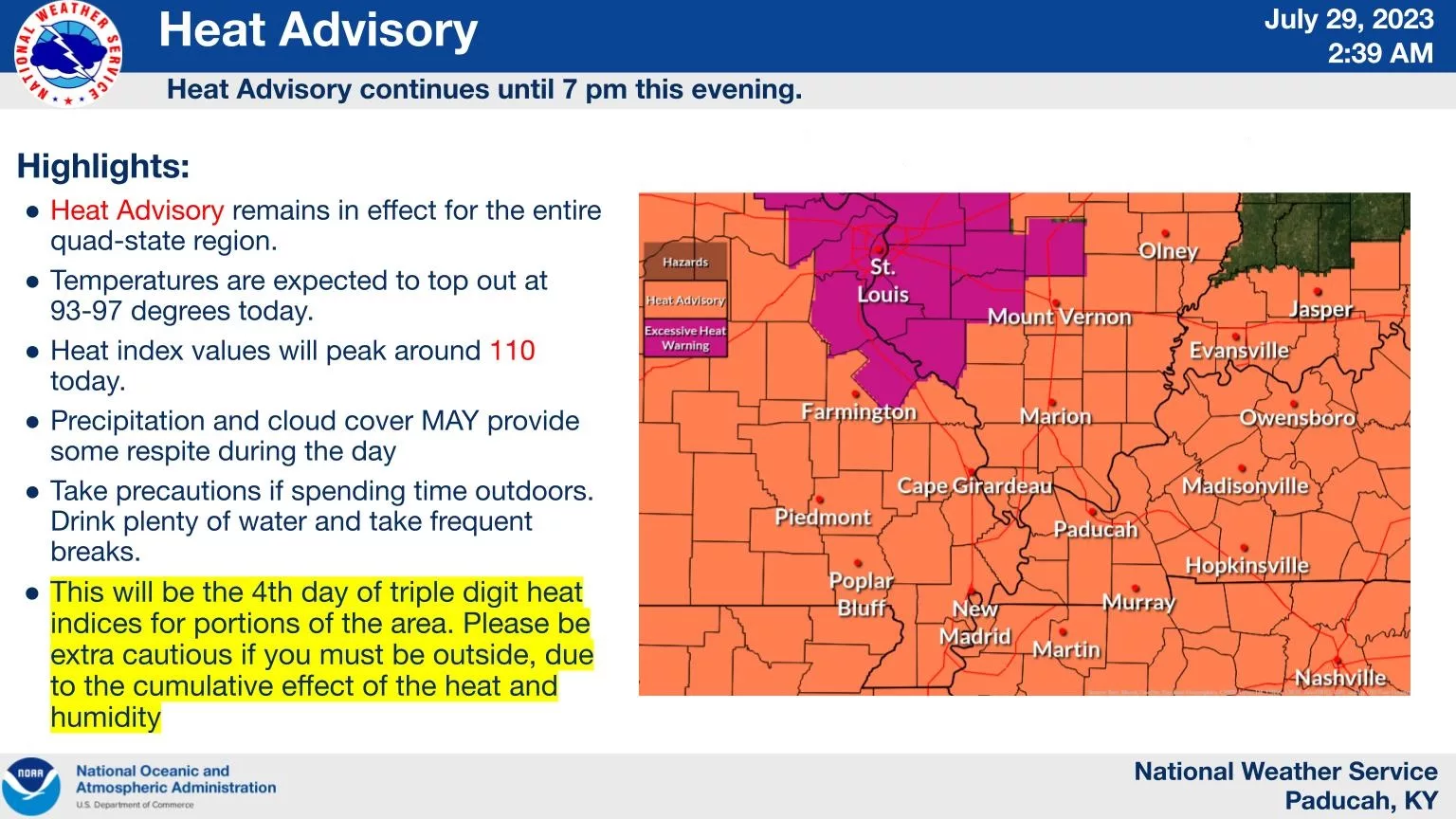
A Heat Advisory remains in effect until 7:00 Saturday night across western Kentucky with a chance for showers and storms by late afternoon.
Weekend showers and storms are continuing to improve drought conditions across the region and more rain is possible throughout the week.
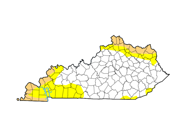
Saturday’s rainfall may have helped with the region’s drought conditions, but for some in western Kentucky, the risk of fire still exists.

Severe storms Friday afternoon and evening caused several thousand electric customers to lose electricity and downed some trees.
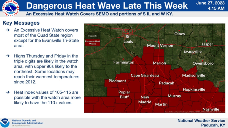
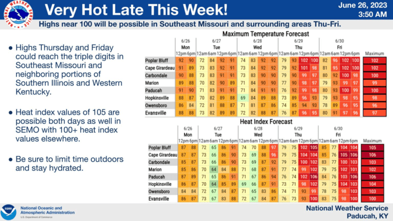
An Excessive Heat Watch has been issued for portions of western Kentucky from Thursday morning to Friday evening.
The “dog days of summer” are nearly upon us, as hot and humid conditions will return in the coming days.
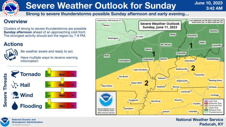
According to the National Weather Service in Paducah, there is a slight chance for severe weather across western Kentucky Sunday.
The area will see an increased risk for fires before we enter the weekend.
A Dense Fog Advisory has been issued for western Kentucky until 8:00 AM Thursday morning.